Monday, November 8, 2021

KERALA


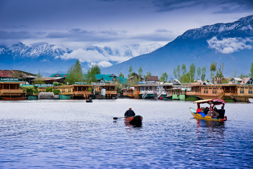
Kerala is a state on the Malabar Coast of India. It was formed on 1 November 1956, following the passage of the States Reorganisation Act, by combining Malayalam-speaking regions of the erstwhile regions of CochinMalabarSouth Canara, and Travancore.[14][15] Spread over 38,863 km2 (15,005 sq mi), Kerala is the twenty-first largest Indian state by area. It is bordered by Karnataka to the north and northeast, Tamil Nadu to the east and south, and the Lakshadweep Sea to the west. With 33 million inhabitants as per the 2011 census, Kerala is the thirteenth-largest Indian state by population. It is divided into 14 districts with the capital being ThiruvananthapuramMalayalam is the most widely spoken language and is also the official language of the state.

The Chera Dynasty was the first prominent kingdom based in Kerala. The Ay kingdom in the deep south and the Ezhimala kingdom in the north formed the other kingdoms in the early years of the Common Era (CE). The region had been a prominent spice exporter since 3000 BCE. The region's prominence in trade was noted in the works of Pliny as well as the Periplus around 100 CE. In the 15th century, the spice trade attracted Portuguese traders to Kerala, and paved the way for European colonisation of India. At the time of Indian independence movement in the early 20th century, there were two major princely states in Kerala: Travancore and Cochin. They united to form the state of Thiru-Kochi in 1949. The Malabar region, in the northern part of Kerala, had been a part of the Madras province of British India, which later became a part of the Madras State post-independence. After the States Reorganisation Act, 1956, the modern-day state of Kerala was formed by merging the Malabar district of Madras State (excluding Gudalur taluk of Nilgiris districtLakshadweep Islands, Topslip, the Attappadi Forest east of Anakatti), the taluk of Kasaragod (now Kasaragod District) in South Canara (Tulunad), and the erstwhile state of Thiru-Kochi (excluding four southern taluks of Kanyakumari district, and Shenkottai taluks).


Kedarnath Dham Yatra

 Kedarnath Dham Yatra  

Kedarnath is one of the most sacred pilgrimages of Lord Shiva situated in Rudraprayag district of Garhwal region in Uttarakhand. Kedarnath is one of the Char Dham in Uttarakhand and the most important dham among Panch kedar. Kedarnath is situated at an altitude of 3586 mts, in the lap of the majestic mountain peaks and near the head of river Mandakini, Kedarnath range stands one of the twelve Jyotirlingas of Lord Shiva.

Kedar meaning powerful is another name of Lord Shiva the protector and the destroyer. The beautiful ambiance around the temple looks like quite peace on heaven causes a beautiful place to do meditation.The main attractions here is the Shiva Temple, which is a popular Hindu shrine and pilgrimage, attracting devotees from all over the world. The travel and tourism scope here is strengthened by factors like natural beauty and religious zest.

Shiva is considered the embodiment of all passions - love, hatred, fear, death and mysticism which are expressed through his various forms. There are more than 200 shrines dedicated to Lord Shiva in the area itself, the most important one is Kedarnath.


About Kedarnath Temple

Kedarnath Temple is the most revered shrine of Hindu deity Lord Shiva. The Mandir was built in 8th century A.D. by Adi Shankaracharya. It is adjacent to the site of an earlier temple built by the Pandavas. Kedarnath is one of India’s most famous temples (more than 1000 years old temple) dedicated to Lord Shiva.

Kedarnath Temple complex is being rehabilitated after 2013 Kedarnath floods. New facilities include helipads, helipad and new guest houses. Online facilities for Kedarnath booking are also there. Kedarnath Puja can be book online and no physical presence of devotees needed. Some pujas could be book on the internet or in person. The daily pooja rituals at the Kedarnath temple start early morning, around 4.00 am with Maha Abhishek and end at around 7.00 pm with the Shyam aarti. The Kedarnath temple opens for darshan for the general public around 6 am.

Visitors can touch idle and perform Abhishek with Ghee before 3 p.m. After 5 p.m., no one can approach Idle, but they can get Darshan from a distance. The temple at Kedarnath opens only six months of the year when the sun enters the zodiac sign of Aries and Scorpio is in full-blown eclipse.

GOA


Goa  is a state on the southwestern coast of India within the Konkan region, geographically separated from the Deccan highlands by the Western Ghats. Goa is popularly known as the Pearl of the orient and tourist paradise. It is surrounded by the Indian states of Maharashtra to the north and Karnataka to the east and south, with the Arabian Sea forming its western coast. It is India's smallest state by area and its fourth-smallest by population. Goa has the highest GDP per capita among all Indian states, two and a half times as high as the GDP per capita of the country as a whole. The Eleventh Finance Commission of India named Goa the best-placed state because of its infrastructure, and India’s National Commission on Population rated it as having the best quality of life in India (based on the commission’s “12 Indicators”). It is the third-highest ranking among Indian states in human development index.

Panaji is the state's capital, while Vasco da Gama is its largest city. The historic city of Margão in Goa still exhibits the cultural influence of the Portuguese, who first voyaged to the subcontinent in the early 16th century as merchants, and conquered it soon thereafter, whereupon Goa became an overseas territory of the Portuguese Empire, part of what was then known as Portuguese India, and remained as such for about 450 years, until it was annexed by India in 1961. Goa’s official language, which is spoken by a majority of its inhabitants, is Konkani.

Goa is visited by large numbers of international and domestic tourists each year because of its white-sand beaches, active nightlife, places of worship, and World Heritage-listed architecture. It also has rich flora and fauna because it lies very close to the North Western Ghauts rain forests, one of the rare biodiversity hotspots of the world


Rajasthan


 Rajasthan  lit. 'Land of Kings') is a state in northern India. It covers 342,239 square kilometres (132,139 sq mi) or 10.4 percent of India's total geographical area. It is the largest Indian state by area and the seventh largest by population. It is on India's northwestern side, where it comprises most of the wide and inhospitable Thar Desert (also known as the Great Indian Desert) and shares a border with the Pakistani provinces of Punjab to the northwest and Sindh to the west, along the Sutlej-Indus River valley. It is bordered by five other Indian states: Punjab to the north; Haryana and Uttar Pradesh to the northeast; Madhya Pradesh to the southeast; and Gujarat to the southwest. Its geographical location is 23.3 to 30.12 North latitude and 69.30 to 78.17 East longitude, with the Tropic of Cancer passing through its southernmost tip

Its major features include the ruins of the Indus Valley Civilisation at Kalibangan and Balathal, the Dilwara Temples, a Jain pilgrimage site at Rajasthan's only hill stationMount Abu, in the ancient Aravalli mountain range and in eastern Rajasthan, the Keoladeo National Park of Bharatpur, a World Heritage Site[12] known for its bird life. Rajasthan is also home to three national tiger reserves, the Ranthambore National Park in Sawai MadhopurSariska Tiger Reserve in Alwar and the Mukundra Hills Tiger Reserve in Kota.

The state was formed on 30 March 1949 when Rajputana – the name adopted by the British Raj for its dependencies in the region– was merged into the Dominion of India. Its capital and largest city is Jaipur. Other important cities are JodhpurKotaBikanerAjmerBharatpur and Udaipur. The economy of Rajasthan is the seventh-largest state economy in India with ₹10.20 lakh crore (US$140 billion) in gross domestic product and a per capita GDP of ₹118,000 (US$1,600).Rajasthan ranks 29th among Indian states in human development index.

The state was formed on 30 March 1949 when Rajputana – the name adopted by the British Raj for its dependencies in the region– was merged into the Dominion of India. Its capital and largest city is Jaipur. Other important cities are JodhpurKotaBikanerAjmerBharatpur and Udaipur. The economy of Rajasthan is the seventh-largest state economy in India with ₹10.20 lakh crore (US$140 billion) in gross domestic product and a per capita GDP of ₹118,000 (US$1,600). Rajasthan ranks 29th among Indian states in human development index.


Sunday, November 7, 2021

Spain

the best place to explore your world.

classic Spanish architecture in Seville

Spain is a country that moves slow and runs late. The land of the siesta, it’s a place for foodies and night owls, history buffs, religious pilgrims, and anyone not in a rush to do just about anything!

It’s a huge country with a lot of variety.

Madrid and Barcelona are hip and energetic cities, Granada has a Moorish touch, Valencia has its own vibe, Catalonia its own language and culture and the Basque region in the north feels like you’re in an entirely different country.

It’s a foodie paradise featuring some diverse and delicious food, there’s music and dancing galore, heaps of art (classical and modern to suit all tastes) as well as beautiful architecture, landscapes, and weather. There’s a ton of history here too, dating back to the Celts and the Roman Empire.

As an added bonus, Spain is pretty cheap. I’ve been visiting the country for over a decade now and I never break the bank while I’m here. It’s really easy to get by on a budget — and you won’t feel like you’re missing out either.

This budget travel guide to Spain can help you plan your trip, save money, and make the most of your time in this vibrant country.

Friday, November 5, 2021

Andaman and Nicobar Islands

 Andaman and Nicobar Islands is a union territory of India consisting of 572 islands, of which 38 are inhabited, at the junction of the Bay of Bengal and the Andaman Sea.

The territory is about 150 km (93 mi) north of Aceh in Indonesia and separated from Thailand and Myanmar by the Andaman Sea. It comprises two island groups, the Andaman Islands (partly) and the Nicobar Islands, separated by the 150 km wide Ten Degree Channel (on the 10°N parallel), with the Andaman islands to the north of this latitude, and the Nicobar islands to the south (or by 179 km). The Andaman Sea lies to the east and the Bay of Bengal to the west. The island chains are thought to be a submerged extension of the Arakan Mountains.

The territory's capital is the city of Port Blair. The total land area of the islands is approximately 8,249 km2 (3,185 sq mi). The territory is divided into three districts: the Nicobar District with Car Nicobar as its capital, the South Andaman district with Port Blair as its capital and the North and Middle Andaman district with Mayabunder as its capital.

The islands host the Andaman and Nicobar Command, the only tri-service geographical command of the Indian Armed Forces.

The Andaman Islands are also home to the Sentinelese people, an uncontacted tribe. The Sentinelese might be the only people currently known to not have reached further than a Paleolithic level of technology,[8] however, this is disputed, as evidence of metalwork was found on their island.


Beautiful Places to Visit in north west of India


1. Nubra Valley in Ladakh

Nubra Valley

Nubra Valley | #1 of 30 Most Beautiful Places in India

The barren rugged view of this valley, which lies between Kashmir and Tibet, will take your breath away. You can feast your eyes on charming monasteries, the Nubra and Shyok rivers, Bactrian camels, and sand dunes. A photographer’s delight, the valley is home to people of the Balti culture in Turtuk.  

  • Best time to visit – June to August
  • Ideal duration – 2 days
  • How to reach – 
    • By Air: Kushok Bakula Rimpochee Airport in Leh is the nearest airport (162 km), from where you can take a bus or taxi. 
    • By Train: Or, you can travel by train to the Leh railway station from Jammu or Kashmir, and then take a taxi or bus. 
    • By Road: You can take a taxi from Leh to reach the valley (160 km away)

2. Khajjiar in Himachal Pradesh

Khajjiar

Khajjiar | #2 of 30 Most Beautiful Places in India

Popularly known as Mini Switzerland, Khajjiar deserves your attention if you are looking for places in India for honeymoon. The combination of lush green meadows, lofty Himalayas encased in snow and dense forests make this place heavenly. Here, you can enjoy adventures like trekking, zorbing, jungle safari and paragliding. 

  • Best time to visit – March to October
  • Ideal duration – 2-3 days
  • How to reach – 
    • By Air: You can fly to Kangra Airport (109 km from Khajjiar) and then take a taxi. 
    • By Train: The closest station is Pathankot (96 km from Khajjiar), from where you can board a taxi. 
    • By Road: You can take a taxi from Dalhousie or Chamba (24 km from Khajjiar). 

Also Read about Skydiving in India

3. Valley of Flowers in Uttarakhand 

Valley of Flowers

Valley of Flowers | #3 of 30 Most Beautiful Places in India

If you are in love with the vibrant colours of nature, this valley should feature on your list of beautiful tourist places in India. Peppered with exotic and rare Himalayan flowers, it attracts trekkers and photographers in droves. This national park is a UNESCO World Heritage Site for good reason.  

  • Best time to visit – July to September 
  • Ideal duration – 1 day of stay, but the trek from Haridwar takes about 6 days. 
  • How to reach – 
    • By Air: Jolly Grant Airport in Dehradun is at 284 km, from where you can hire a cab till Joshimath (11 hours). Gobindghat is another hour from here. From Gobindghat, you have to trek for 13 km to reach the Ghangaria base camp. 
    • By Train: Rishikesh railway station is 273 km from Gobindghat, and you can take a taxi or bus from the station.
    • By Road: You can get a bus or taxi from Rishikesh, Rudraprayag, Srinagar, Pauri, or Chamoli. 

4. Dal Lake in Srinagar

Dal Lake

Dal Lake | #4 of 30 Most Beautiful Places in India

The serene Dal Lake is one of the most beautiful places in India to visit before you die. Also known as the Lake of Flowers or Srinagar’s Jewel, it is 1775 m above sea level, and a shikara ride on the lake can lift your spirits instantly. 

  • Best time to visit – May to November 
  • Ideal duration – 1 day (in a houseboat if possible)
  • How to reach – 
    • By Air: You can reach Srinagar International Airport (22 km from Dal Lake) and then take a cab. Or, you can hire a cab to reach Lal Chowk and then board a bus. 
    • By Train: The nearest railway station is in Jammu (272 km from Srinagar). You can take a bus or taxi from there. 
    • By Road: Take a taxi or bus from Jammu. Srinagar can also be reached via road from Delhi or Chandigarh.  

Sunday, October 31, 2021

Angkor Wat - Cambodia


Do not leave the wonderful country of Cambodia without visiting the "City of Temples", a large archaeological complex made up of numerous ancient temples and other monuments. Probably the most famous temple is Angkor Wat, visit it at sunrise and shoot unparalleled pictures for your home!

Angkor Wat combines two basic plans of Khmer temple architecture: the temple-mountain and the later galleried temple. It is designed to represent Mount Meru, home of the devas in Hindu and Buddhist cosmology. Unlike most Angkorian temples, Angkor Wat is oriented to the west. Scholars are divided as to the significance of this. The temple is admired for the grandeur and harmony of its architecture, extensive bas-reliefs, and statues of Buddhas and Devas that adorn its walls.


Saturday, October 30, 2021

The pyramids of Giza - Egypt


If there is a historic place in the world to visit, then it is Egypt! Such as the unparalleled history of the pharaohs, the huge pyramids in the desert and the towering capital of Cairo. We recommend that you do not miss all this during your holiday in Egypt. The famous Pyramids of Giza, which consist of a total of 6 pieces, are among the oldest buildings in the world. You will be enchanted!


The Great Pyramid was built by quarrying an estimated 2.3 million large blocks weighing 6 million tonnes total. The majority of stones are not uniform in size or shape and are only roughly dressed. The outside layers were bound together by mortar. Primarily local limestone from the Giza Plateau was used. Other blocks were imported by boat down the Nile: White limestone from Tura for the casing, and granite blocks from Aswan, weighing up to 80 tonnes, for the King's Chamber structure.

The Amazon rainforest - South America

Deep green and full of life: these are the key facts of the Amazon rainforest. There is probably no other jungle in the world that is so impressive. For good reason, the Amazon is also called "the green lung of the earth". Wander through the jungle to the most extraordinary places.


Natural


The rainforest likely formed during the Eocene era (from 56 million years to 33.9 million years ago). It appeared following a global reduction of tropical temperatures when the Atlantic Ocean had widened sufficiently to provide a warm, moist climate to the Amazon basin. The rainforest has been in existence for at least 55 million years, and most of the region remained free of savanna-type biomes at least until the current ice age when the climate was drier and savanna more widespread.

Human activity


Based on archaeological evidence from an excavation at Caverna da Pedra Pintada, human inhabitants first settled in the Amazon region at least 11,200 years ago. Subsequent development led to late-prehistoric settlements along the periphery of the forest by AD 1250, which induced alterations in the forest cover. rainforest was never more than sparsely populated, as it was impossible to sustain a large population through agriculture given the poor soil. Archeologist Betty Meggers was a prominent proponent of this idea, as described in her book Amazonia: Man and Culture in a Counterfeit Paradise. She claimed that a population density  the maximum that can be sustained in the rainforest through hunting, with agriculture needed to host a larger population.However, recent anthropological findings have suggested that the region was actually densely populat


KERALA

  Kerala  is a state on the  Malabar Coast  of  India . It was formed on 1 November 1956, following the passage of the  States Reorganisatio...